Cañaveral
Location
Zaino Sector, Tayrona National Park
Distance
35 km / 21.7 mi
Difficulty
Moderate hike
Highlights
Wild scenery
Current temperature at this beach
Temperature
25.4°C
Humidity
81%
Rain
0.0 mm
Updated
Jun 24, 6:00 AM
For full cross-beach comparison and 7-day averages, open the beaches temperature hub.
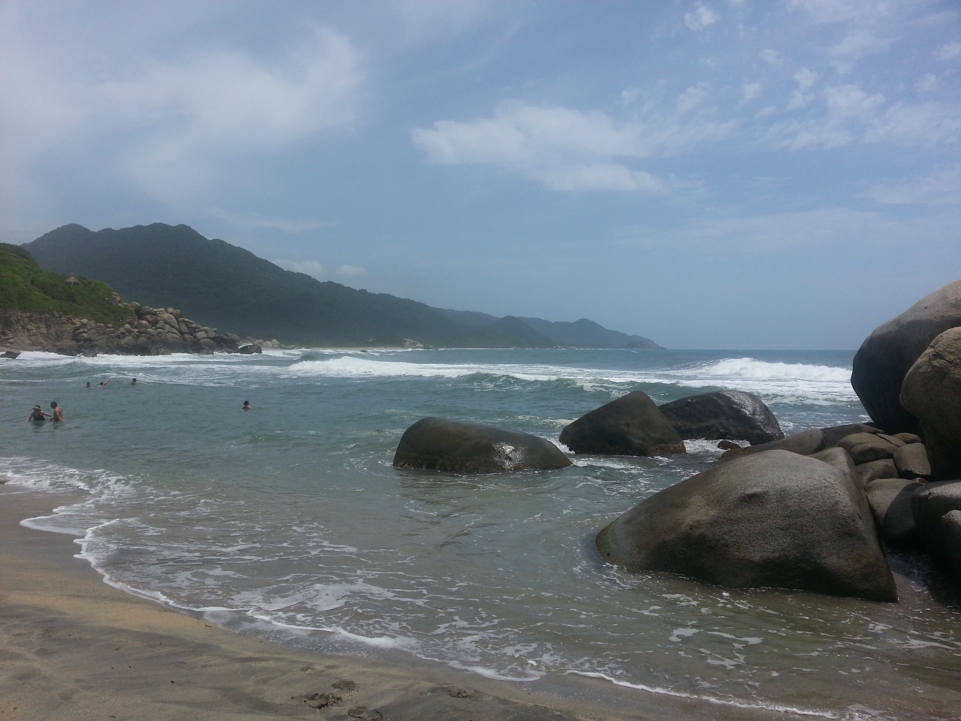
Cañaveral is one of the first major coastal sectors reached from Tayrona's Zaino entrance. It is visually dramatic, backed by dense vegetation and known for ecohabs and one of the park's classic wild-coast views. It is more about scenery and the experience of being inside Tayrona than about carefree swimming.
To decide this beach properly today, combine live map + water temperature + live weather + Santa Marta facts.
Highlights
Interactive marine forecast
Dynamic coordinates: 11.3146, -73.9458
Loading marine conditions...
Beach map
Nearby beaches
Plan your visit
Best time to visit
Dry season mornings
Entrance fee
Not specified
Closure dates
Not specified
Getting there
Enter via El Zaino, then continue into the park by internal shuttle and walking routes.
Insider tip
Plan Cañaveral as a scenic Tayrona route stop for photos and coastline views, not as a relaxed swim session.
Warnings
- Surf can be dangerous
- Swimming conditions are often not the main draw here
Where to eat near Cañaveral
After your beach block, use these dining guides by zone and trip style: beachfront meals, seafood priorities, or neighborhood comparisons with different logistics.
Keep planning your route
Suggested hotels near this area